New York ParksMORE OUTSIDE. CLOSER TO HOME.

Letchworth State Park

Livingston · Wyoming · New York State Office of Parks, Recreation and Historic Preservation

BEFORE YOUR VISIT
Visitor advisoryFacilities

Letchworth: construction affects several campground loops

Park-specific information

Shower-building work affects campground loops 300, 400, 500, 600 and 800. The agency gives July 2, 2027 as a tentative reopening date for those loops. Other camping and cabin options have separate availability; check the official notice and reservation system.

PLAN YOUR VISIT

The practical details.

Managing agency
New York State Office of Parks, Recreation and Historic Preservation
Address
1 Letchworth State Park Castile, NY 14427
Telephone
(585) 493-3600
Official park information Reservations

We have not yet verified hours, entry fees, accessibility details. Confirm these with the managing agency before traveling.

Check notice timestamps and official updates. Conditions can change between source checks.

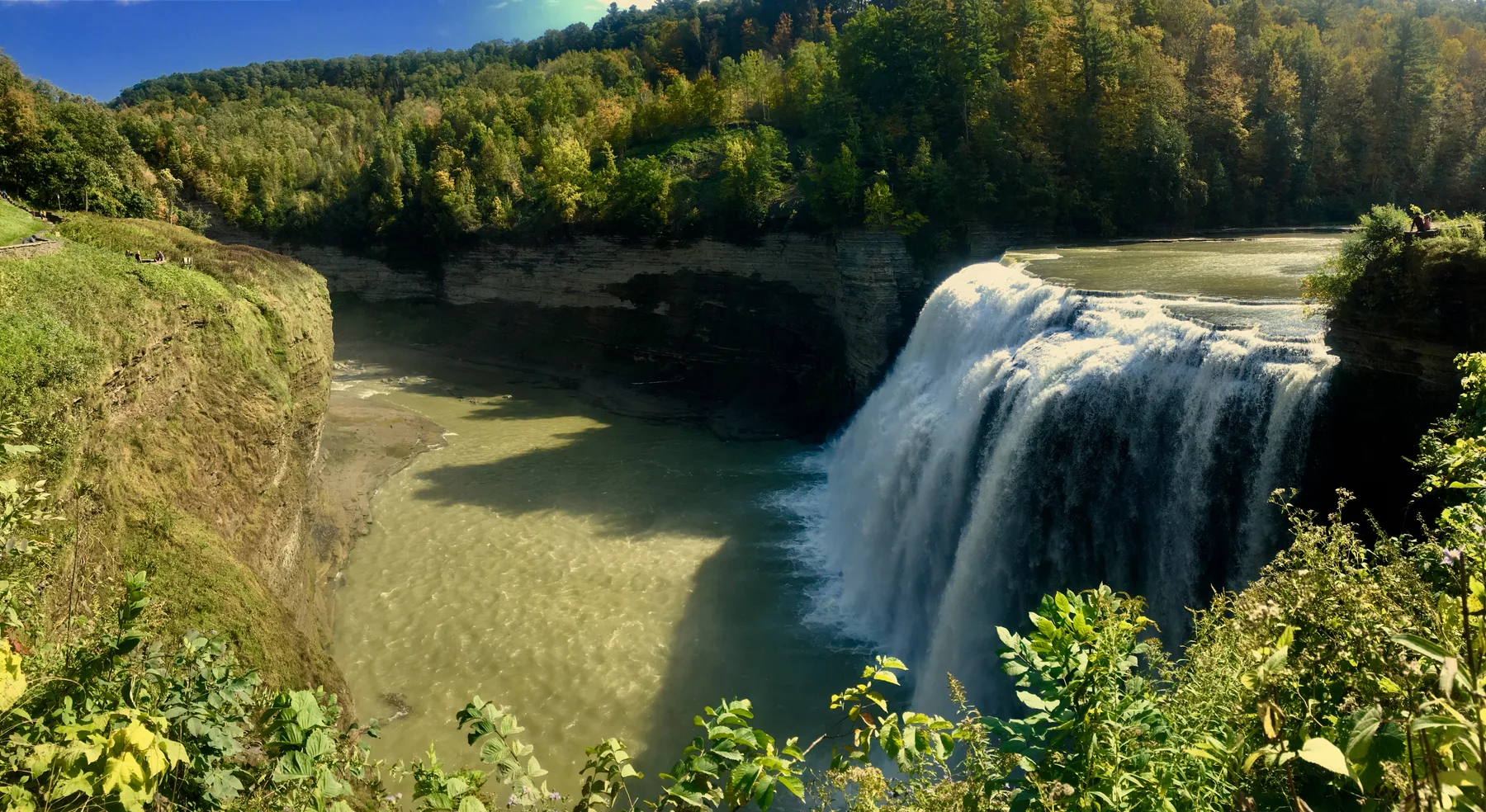
Middle Falls on the Genesee River in Letchworth State Park, New York
Photo: Andre Carrotflower · Source & CC BY-SA 4.0

About Letchworth State Park

Explore the Genesee River gorge and its three major waterfalls. The park offers hiking routes and seasonal camping; check the official page for entrance and campground details.

Activities & facilities

Biking ↗Camping ↗Horseback riding ↗Fishing ↗Hiking ↗Hunting ↗Playgrounds ↗Cross-country skiing ↗Swimming ↗Camper Assistance ProgramCampsites, Cabins & LodgingEquestrian TrailsFoodGift ShopGrillsHiking TrailsNature CenterEvent Rentals: Pavilions, SheltersPlaygroundPlaying Field(s)ShowersSnowmobile TrailsSnowshoeing, X-Country SkiingSwimming PoolVisitor CenterWaterfall

Recorded from park sources. Availability and restrictions may vary by season or visitor area.

Mapped hiking trails.

OpenStreetMap routes that intersect recorded park boundaries. Distances cover each route’s mapped New York portion, which may extend beyond this park. Check official maps and current access rules.

All mapped hiking routes ↗

Trail data © OpenStreetMap contributors · ODbL

Find your way.

Loading map…

Map points represent park land, not verified visitor entrances. Follow the managing agency’s entrance directions. Tiles © OpenStreetMap contributors.

This point represents park land, and may not be a public entrance. Follow official entrance directions.

Official visitor information & directions ↗

Read before you roam.

Sources & verification

Park facts and notices are checked separately. Missing facility information does not mean a facility is absent. Official visitor page checked Oct 27, 2026.

Suggest a correction · Markdown version